Located at an altitude of 800 m sea level, dark clouds cover the top of the pass when it is going to rain, people cannot see each other's faces clearly within 5 meters apart, but when the clouds disperse, the golden sunlight is exposed and the weather is getting warmer.
Looking from the top of Gia Bac Pass, we felt a surprisingly magnificent scene with enormous and extended mountains and coffee hills... It was not only our group but also dozens of tourists and backpackers who chose Highway 28 for the Phan Thiet - Da Lat route to experience the spectacular Gia Bac Pass. It is difficult to count all the large and small passes on Highway 28. However, the rugged arcs, over 10 kilometers long of Gia Bac Pass, the top of the pass - the boundary between Di Linh district (Lam Dong) and Ham Thuan Bac district (Binh Thuan) leave an unforgettable impression.
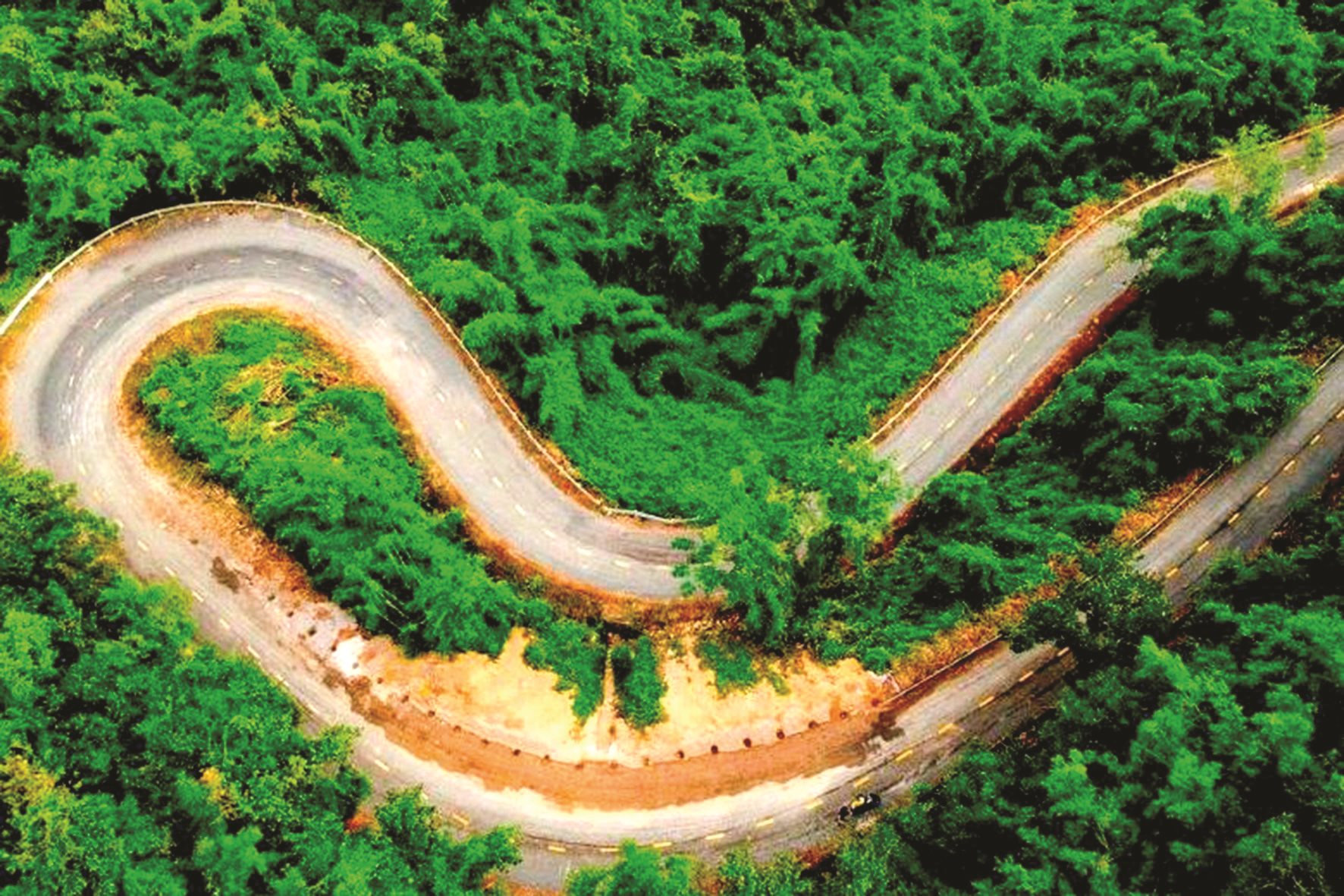
Gia Bac Pass is known as one of the most beautiful passes in the Southern region. The pass road is not wide enough, so many curves only have enough space for one lane in both directions. When moving on Gia Bac Pass, people cannot deny that the scenery on this pass is magnificent, with extended mountains and vast coffee hills stretching endlessly. Gia Bac Pass was formed a long time ago, for more than 100 years. It was a historical events' witness. Initially, it was a trail south of Di Linh explored by the K'ho people, who brought products from the mountains and forests to the plain in exchange for salt. After that, the French colonialists brought the Kinh and Montagnard people up from the plain to expand the pass and pave the way.
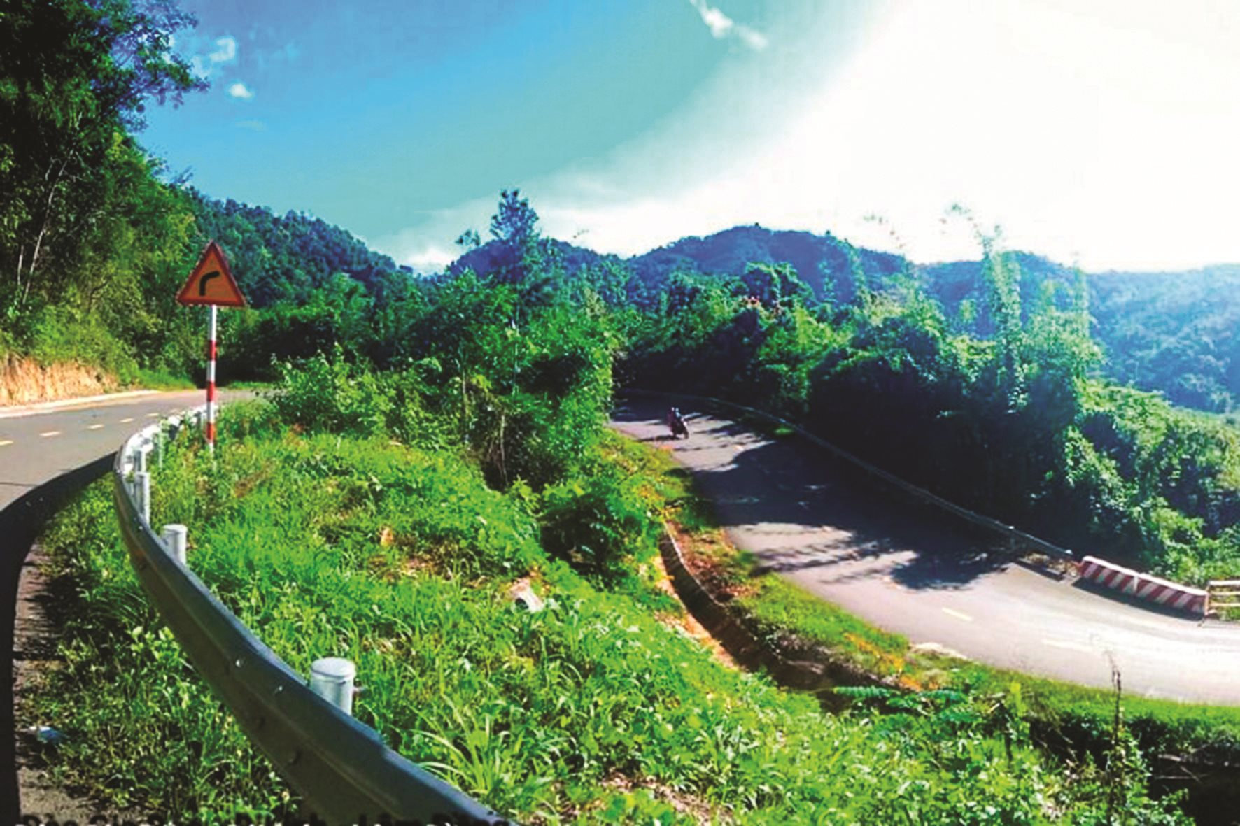
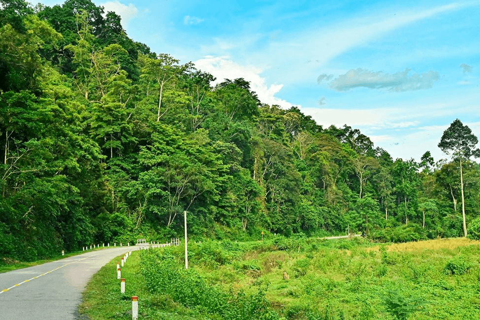
Gia Bac Pass is quite narrow. If you go to the top of the pass, you will see the surrounding scenery shrink and the innumerable and extensive forests or coffee hills. A few small, beautiful houses located on both sides of the road make the natural scenery here even more lively. Especially, the scenery here will be even more wonderful when fog covers the mountains. Recently, Gia Bac Pass has attracted many tourists because of the majesty and beauty that nature bestows. When reaching the top of the pass, the landscape becomes even narrower, the mountains, forests, and coffee hills stretch out and are impressive. The road to the top of the pass is a cliff on one side and a mysterious deep crevasse on the other. All features together create a wild but fantastic landscape that is extremely attractive. The top of Gia Bac Pass is about 800 m above sea level, deep in the mountains and forests, and has a very poetic beauty when covered with fog. Stopping at the pass top, visitors feel like they are harmonized in the magnificent nature. They just want to immerse themselves in the amazing scenery for a long time to enjoy the aroma of the vast coffee hills and the jungle.
Gia Bac Pass
The 175 km journey from Phan Thiet to Da Lat City along the Highway 28 route on the winding, adventure, and poetic, Gia Bac Pass was the most interesting and memorable experience of my first days of the year. We hope that one day Highway 28 on Gia Bac Pass will be upgraded and expanded for a safer journey.
Translated by Uyen Linh