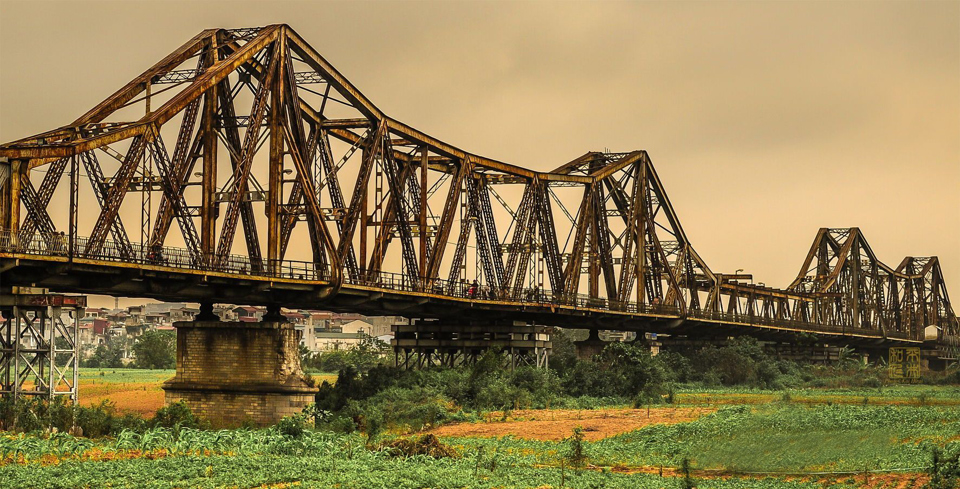
The City People's Committee has agreed to allow the four districts to continue studying the project "Developing the middle alluvial land on the Red River into a multi-purpose cultural park". Funding for the development would come from the districts' budgets.
Multi-purpose cultural park

The alluvial land under the Long Bien Bridge will become a cultural park. Photo: Viet Dung/The Hanoi Times
According to Pham Quoc Tuyen, deputy director of the Hanoi Department of Planning and Architecture, this area is planned for specialized green parks, agriculture and tourism.
The formulation of the project aims to concretize the orientation of Hanoi's Capital Construction Master Plan to 2030 with a vision to 2050; to effectively utilize the land fund and the potential advantages and natural beauty of the Red River; to take the Red River as the landscape axis to create an open, green space with civilized and modern urban infrastructure, making it a destination for entertainment and sightseeing.
According to the Red River Urban Subdivision Planning, the Red River stretch in Hanoi flows through an area of about 686 hectares in the downtown area from Thang Long Bridge to Thanh Tri Bridge, where more than 181,000 people live. This place will be a multi-functional area, including cultural, commercial, and public areas.
In the riparian area, a green park space (where existing large trees will be preserved) will be planted with short-rotation trees, ornamental plants, seasonal flowers, and tourist services. In addition, a sports area, community art space, and creative space focusing on the historical and cultural values of the Red River will be built in the riverbank area of Hoan Kiem District.
Many things to do
This is not the first time the idea has been raised. Previously, in March 2022, Hoan Kiem District drafted a plan to turn the alluvial land into a cultural and tourism park, and later with Long Bien District drafted a plan to develop one hectare of alluvial land in Long Bien District.
The Hoan Kiem District People's Committee conducted a survey on further land reclamation in the riverbanks of Phuc Tan and Chuong Duong wards with the aim of effectively utilizing the land resources and beauty of the Red River and developing it into a tourist destination.
However, professional agencies of the city said that the park development on the alluvial islet of the Red River must be in line with the urban subdivision of the Red River, which stipulates the overall development of the alluvial land and both banks of the river stretch in Hanoi.
Hoan Kiem District has held a meeting with Ba Dinh, Tay Ho and Long Bien districts and all have agreed on a design proposal for the park development.

In the near future, the alluvial islet will be turned into a green space and possibly a park. Photo: Ngoc Tu/The Hanoi Times
Architect Pham Thanh Tung, chief secretary of the Vietnam Association of Architects, said it was a good idea because in the near future, the alluvial land would become a green space and possibly a park.
However, many issues must be thoroughly considered before making any decisions.
"What will a multifunctional cultural park need, and what will be the connections between the park and the existing residential area?" he asked, adding that the implementation must take into account detailed plans to make it fit into the current transportation infrastructure and landscapes, rather than being implemented separately.
When some people suggested developing a park in the middle alluvium of the Red River, some analysts said they were concerned that the project might be a waste. The funds for such a project would be better invested in making full use of many parks in the downtown area, they said.
For example, construction of the 100-hectare Kim Quy Culture, Tourism and Entertainment Park in Dong Anh began in 2016 but hasn't been completed; the 7.09-hectare Dong Da Park has been planned for 20 years, but land clearing hasn't been completed. Hanoi authorities have promised to revive these parks by 2023.
Regarding the proposal to develop a park on the alluvial land of the Red River, Tung said that this area must comply with two important master plans, namely the master plan on dikes and flood prevention; the second is the adjustment of the Capital Master Plan approved by the Prime Minister in 2011.
Ngo Minh